OMP-GIS is a fully integrated thematic mapping module in OMP Plantation 10 that allows you to uncover the hidden spatial trends in your OMP Plantation data. The power of OMP-GIS lies in its exceedingly simple menu-driven user interface and dozens of built-in maps, which means that it is no longer necessary to be a GIS expert to utilize the capabilities of spatial data analysis. OMP-GIS supports mapping of both point-level and block-level data.
Prerequisites
Two prerequisites are required to use OMP-GIS. First and foremost, you need an OMP Plantation database to act as the data source for the GIS database used to feed your thematic maps. The second ingredient is a basic block map with the block boundaries of your estate. The Agrisoft Systems team can assist you with the procedure to create such a basic block map from a satellite image or by manually tracing the block boundaries with a handheld GPS device.
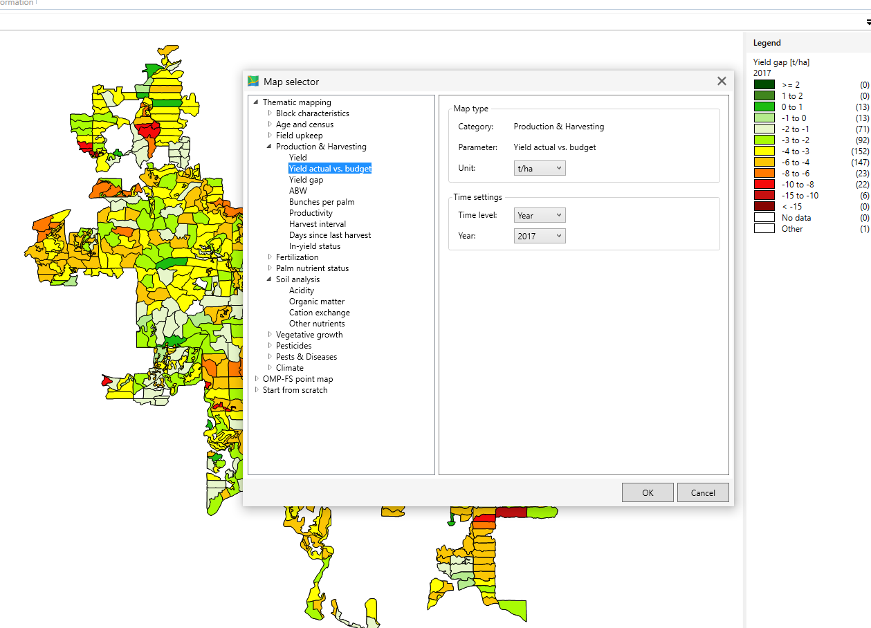
OMP-GIS map selector menu
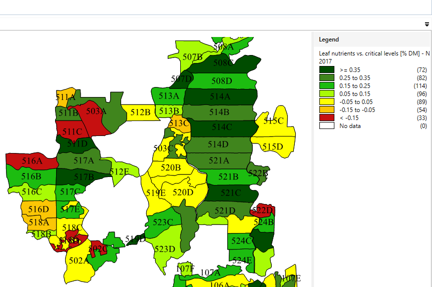
GIS map of leaf nitrogen vs critical level
OMP-GIS Features
Thematic maps that can be directly displayed from the OMP-GIS menu include
- Yield parameters: monthly or annual yield, production, average bunch weight, bunch number
- Harvesting data: harvester productivity, harvest round lengths
- Block characteristics: soil class, planting material, planting date, tree age, blocks in or out of production
- Leaf and soil analysis: rachis, pinnae and soil nutrient levels, deficiency symptoms, soil texture
- Environment and climate: rainfall and water deficit, erosion, drainage, topography, ground cover
- Palm census data: mature and immature area, stand per hectare at planting and actual
- Fertilizer and nutrients: application and recommendation by fertilizer or by nutrient
- Pests and diseases: pest and disease events, severity by month, pesticide application
- Field survey data: point maps for any kind of data collected with OMP Field Survey
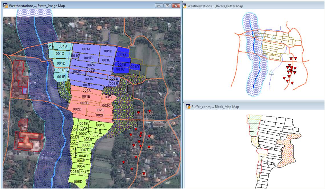
GIS map with background layer
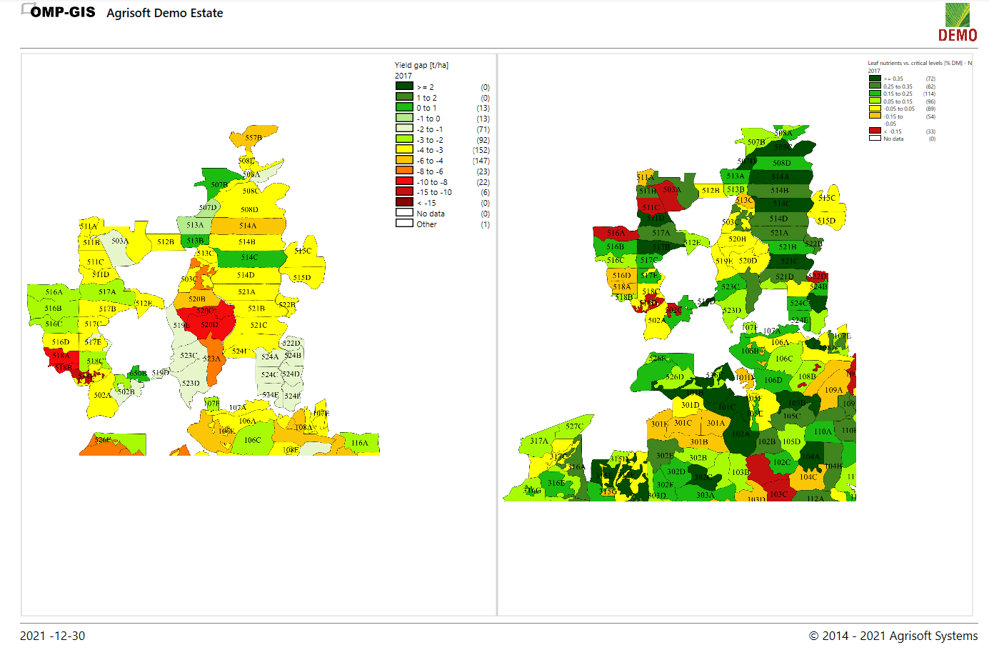
Multi-map layout in landscape format
OMP-GIS supports multi-map print layouts of up to 4 maps. These multi-map layouts are a great tool to compare different but related information (e.g. N nutrient levels and urea application or rainfall and yield or pest severity from one month to the next) and can be printed out in large format for display in the estate office. Comparing a well-chosen set of maps in this manner often allows managers to see at a glance what is affecting their yield and where action needs to be taken.
If required, any additional layers that may be available such as roads, infrastructure or river buffer zones can be overlaid on top of the thematic OMP-GIS maps. Satellite images can be added as background if desired. All OMP-GIS maps can be exported in image format or directly to Google Earth.
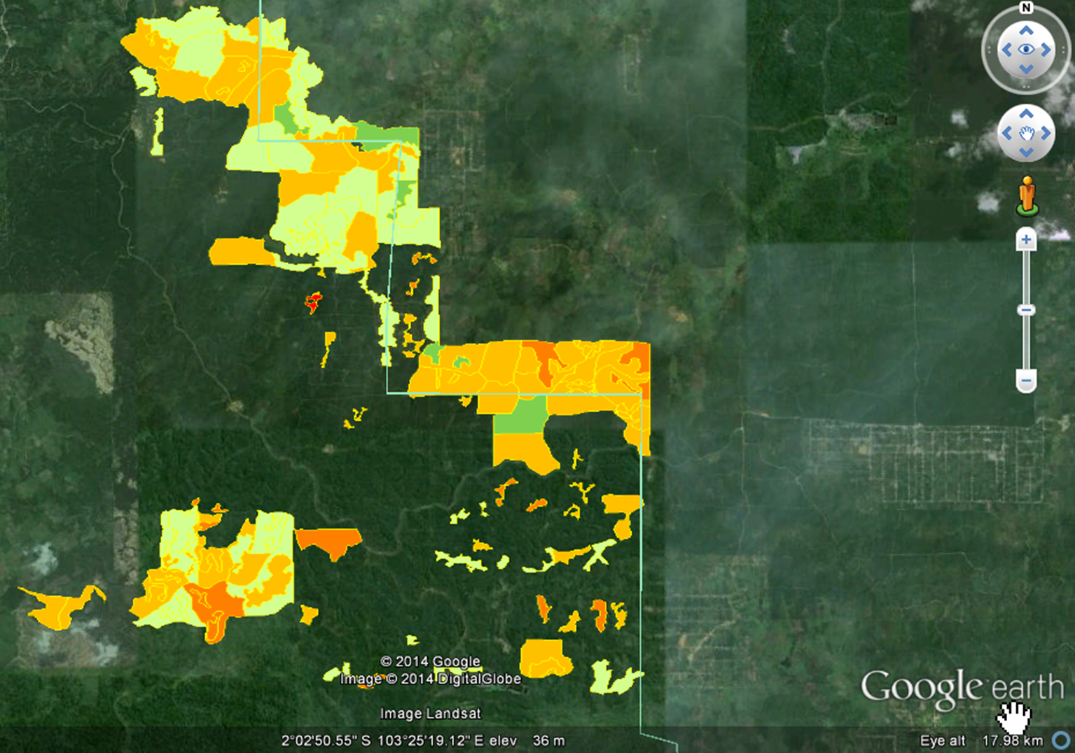
OMP-GIS map exported to Google Earth